Reguladores buscarán retorno 737 MAX
AW | 2019 09 14 20:49 | INDUSTRY / AVIATION SAFETY
 The Boeing Company aplica máximo esfuerzo por devolver al 737 MAX a los cielos
![]()
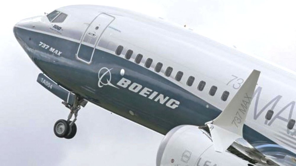
Boeing prepara un gran esfuerzo para devolver Boeing 737 MAX a los cielos del mundo. Mientras el constructor americano apunta a obtener la aprobación para volar su 737 MAX en cuestión de semanas, luego de una prohibición de seguridad de seis meses, los ingenieros de todo el mundo están implementando planes para una de las mayores operaciones logísticas en historia de la aviación civil, la evaluación de los reguladores mundiales para fiscalizar las aprobaciones de los últimos cambios en la seguridad de la aeronave en cuestión.
Dentro de la fábrica de Boeing en Renton, Washington, al sur de Seattle, los trabajadores han premontado kits de herramientas dedicadas para técnicos encargados de instalar actualizaciones de software y preparar más de 500 aviones Boeing 737 MAX que han estado inactivos durante meses, dijeron fuentes internas. Boeing tendrá que articular bien las entregas de las 250 unidades de las diferentes variantes producidas desde la prohibición de vuelo del 737 MAX, estacionadas en varias instalaciones y aquellos que saldrán de la línea de producción después de la aprobación.
La reubicación de cientos de aviones inactivos 737 MAX, que aportan aproximadamente el 40% de las ganancias antes de impuestos de Boeing, es crucial para la salud del principal exportador corporativo de Estados Unidos y el sector manufacturero más amplio del país, cuya reciente pérdida de impulso ha llevado aún más lejos golpe de la crisis. Boeing recibe gran parte de su efectivo en el momento de la entrega y Fitch Ratings & Moody’s han advertido que su perspectiva estable puede estar en riesgo, ya que sus entregas de aviones caen un 72% este año.
Los preparativos para un retorno al servicio se ajustan a la suposición actual de la compañía de que el 737 MAX reanudará los vuelos comerciales en el plazo de Octubre-Diciembre 2019, expresó el Presidente Ejecutivo Dennis Muilenburg.
 Reguladores mundiales
El Wall Street Journal informó el 1 Septiembre 2019 que una reunión informativa de Boeing en Agosto 2019 fue interrumpida por los reguladores estadounidenses, europeos y otros que se quejaron de que la compañía no respondió preguntas específicas sobre modificaciones en la operación de las computadoras de control de vuelo del 737 MAX.
En todo el mundo, los equipos de Boeing están preparando horarios de entrega, y términos financieros, con clientes de líneas aéreas que se han visto obligados a cancelar vuelos, cortar rutas y volar viejos aviones mientras esperan el regreso de 737 MAX. Aunque los reguladores aún deben aprobar los aviones para el vuelo, Boeing y el personal y los ejecutivos de la aerolínea dicen que el fabricante de aviones más grande del mundo tiene semanas en un plan detallado para la producción, el mantenimiento y la entrega que, según una fuente, involucra a 1.500 ingenieros.
Boeing está esperanzada de devolver al 737 MAX en el 4Q2019. Pero la línea de tiempo está en manos de reguladores divididos en todo el mundo que deben aprobar la solución de software propuesta por Boeing para los controles de vuelo del Boeing 737 MAX y nuevos materiales de capacitación. Los reguladores europeos planean sus propios vuelos de prueba sobre los cambios. «No controlamos esa línea de tiempo. Vamos a trabajar con los reguladores y estamos avanzando hacia esa línea de tiempo. Pero si esa fecha de regreso al servicio cambia, afectará todo lo demás», dijo Dennis Muilenburg.
Boeing atenderá una flota de 387 aviones Boeing 737 MAX que entraron en servicio antes de la puesta a tierra, aunque Boeing ya ha desplegado equipos en todo el mundo para ayudar a las aerolíneas a prepararse para ese proceso.
La Federal Aviation Administration (FAA) ha dicho repetidamente que no certificará que el avión Boeing 737 MAX vuelva a volar hasta que sea seguro hacerlo. En tanto la Agencia de Seguridad Aérea de la Unión Europea (EASA) dijo el Martes 10/09 que «tiene la intención de realizar sus propios vuelos de prueba por separado, pero en plena coordinación con la FAA. Los vuelos de prueba aún no están programados, la fecha dependerá del programa de desarrollo de Boeing».
Muilenburg dijo que es posible que no todos los reguladores de todo el mundo aprueben simultáneamente el 737 MAX para volar nuevamente. Boeing ha dicho que planea realizar un vuelo de prueba de certificación para este mes. Algunos funcionarios no esperan que el 737 MAX reanude los vuelos hasta principios de 2020.
En cuanto a la República de la India, realizará su propia revisión del Boeing 737 MAX después de que la FAA complete sus pruebas, antes de que pueda volar en el espacio aéreo indio. Boeing espera tener el 737 MAX volando a principios del cuarto trimestre 2019, pero la Dirección General de Aviación Civil (DGAC) de la India no espera que el avión vuele en India antes del próximo año.
India ha sido el mercado de viajes aéreos nacionales de más rápido crecimiento durante cuatro años consecutivos, según la Asociación Internacional de Transporte Aéreo (IATA).
 Boeing testea al 737 MAX
Boeing ha dicho a los proveedores que espera que el avión vuele a principios de Noviembre 2019. Una vez que los reguladores certifiquen el 737 MAX para el vuelo, Boeing tendrá que movilizar a cientos de mecánicos y pilotos para sacar de la hibernación a los aproximadamente 250 aviones almacenados.
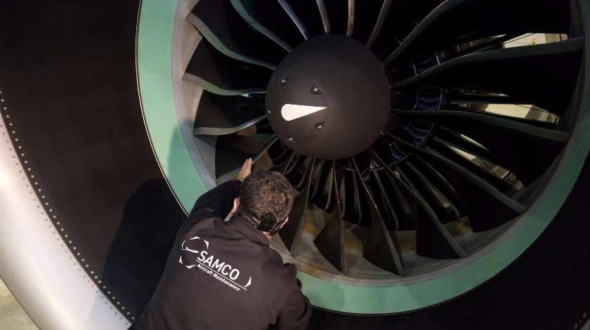
Las aerolíneas estiman que el proceso, que incluye la instalación de un nuevo software, el cambio de líquidos y el ciclo de los motores, tomará de 100 a 150 horas por avión y meses en total para Boeing. En un ejemplo que destaca los riesgos minúsculos que podrían invertir meses de planificación, un equipo de empleados está analizando años de datos sobre las nevadas de Diciembre en un aeropuerto en la zona rural de Moses Lake, Washington, donde Boeing ha estacionado cerca de 100 aviones, para predecir la demanda de aviones anticongelamiento y rendimiento en la pista. El proceso de mantenimiento será seguido por varios días de vuelos de prueba como parte de un período estándar de aceptación del cliente, pero otro desafío es encontrar suficientes pilotos para superar la acumulación. Como resultado, Boeing está explorando un acuerdo para pilotos temporales con la tripulación aérea y proveedor de capacitación CCL Aviation con sede en la Isla de Man para complementar a los pilotos de su personal, dijo una persona con conocimiento del asunto.
 Turno de las aerolíneas
No está claro qué clientes recibirán primero las entregas. Mucho dependerá de qué tan rápido otros reguladores globales que han prometido su propio escrutinio sigan el ejemplo de los Estados Unidos. «Dada la acumulación de aviones almacenados, ese proceso de aceptación del cliente podría retrasarse», dijo Andrew Watterson, Director de Ingresos de Southwest Airlines.
Algunos, como United Airlines, han dicho que quieren los aviones tan pronto como sea posible, pero otros pueden aprovechar la oportunidad para ajustar las entregas. Si bien las aerolíneas habían estado ansiosas por agregar los modelos de ahorro de combustible antes del verano pico del hemisferio norte, menos tienden a agregar capacidad en el mes más tranquilo de noviembre.
El eventual retorno del Boeing 737 MAX también pondrá a prueba un mercado de aviación cada vez más frágil. El crecimiento del tráfico se ha reducido desde la base, en parte como resultado de las tensiones comerciales mundiales, según la Asociación Internacional de Transporte Aéreo (IATA). Dennis Muilenburg ha minimizado las preocupaciones sobre la demanda de las aerolíneas, diciendo en una conferencia esta semana que el mercado sigue siendo sólido.
Unos 250 aviones están almacenados, pero alrededor de una docena están destinados a arrendadores que aún no los han colocado en las aerolíneas, o fueron construidos para transportistas ahora en quiebra como Jet Airways, dijeron fuentes de la industria. Los analistas dicen que algunas aerolíneas pueden tratar de usar la conexión a tierra como una cortina de humo para tratar de cancelar los pedidos, algo que Boeing resistiría.
Las principales aerolíneas estadounidenses han cancelado vuelos hasta Diciembre 2019 como resultado de la conexión a tierra 737 MAX, incluidas American Airlines y United Airlines, mientras que Southwest Airlines ha cancelado vuelos a principios de Enero 2020.
Estado solicita investigaciones
El Jueves 12 Septiembre 2019, el Congreso de los Estados Unidos solicitó al Director Ejecutivo Dennis Muilenburg de la compañía americana The Boeing Company, que pusiera a disposición a varios empleados para entrevistas como parte de una investigación del Congreso sobre el diseño, desarrollo y certificación de aviones 737 MAX involucrados en dos accidentes aéreos.
El Presidente del Comité de Transporte de la Cámara de Representantes, Peter DeFazio, y el Representante Rick Larsen, que preside el Subcomité de Aviación, dijeron en un comunicado que, si bien Boeing ha proporcionado documentos sustanciales y ha compartido la perspectiva de la alta gerencia, «es importante para la investigación del comité escuchar a los empleados relevantes de Boeing». El Comité planea otra audiencia de Boeing en las próximas semanas y previamente solicitó a los denunciantes que presentaran cualquier información sobre el desarrollo del avión. Boeing ha proporcionado más de 300.000 páginas de documentos, dijo una persona informada sobre el asunto, que habló bajo condición de anonimato. Boeing dijo en un comunicado que estaba «profundamente decepcionado de que el Comité eligiera publicar correspondencia privada dada nuestra amplia cooperación hasta la fecha. Seguiremos siendo transparentes y receptivos al Comité».
El 737 MAX, el avión más vendido de Boeing, aterrizó globalmente en Marzo 2019, días después del accidente del vuelo ET-302 de Ethiopian Airlines que siguió a un desastre similar del primer accidente del vuelo JT-610 de Lion Air en Indonesia en Octubre 2018. Un total de 346 personas murieron en los dos accidentes aéreos.
Los fiscales federales con la ayuda del FBI, el Inspector General del Departamento de Transporte (DOT) y varios paneles están investigando el 737 MAX y cómo la Administración Federal de Aviación (FAA) certifica nuevos aviones.
El Presidente Ejecutivo de Boeing dijo en una conferencia de inversionistas el Miércoles 11 Septiembre 2019 que la compañía todavía está apuntando «a principios del cuarto trimestre para que el avión vuelva a estar en el aire, el regulador determinará en última instancia el tiempo de retorno al servicio».![]()
 Regulators will seek 737 MAX return
 The Boeing Company applies maximum effort to return 737 MAX to the skies
Boeing prepares a great effort to return Boeing 737 MAX to the skies of the world. While the American builder aims to obtain approval to fly its 737 MAX in a matter of weeks, after a six-month security ban, engineers around the world are implementing plans for one of the largest logistics operations in aviation history civil, the evaluation of global regulators to monitor the approvals of the latest changes in the safety of the aircraft in question.
Inside the Boeing factory in Renton, Washington, south of Seattle, workers have pre-assembled dedicated tool kits for technicians responsible for installing software updates and preparing more than 500 Boeing 737 MAX aircraft that have been idle for months, sources said. internal Boeing will have to articulate well the deliveries of the 250 units of the different variants produced since the 737 MAX flight ban, parked in several facilities and those that will leave the production line after approval.
The relocation of hundreds of inactive 737 MAX aircraft, which contribute approximately 40% of Boeing’s pre-tax profits, is crucial to the health of the main corporate exporter in the United States and the largest manufacturing sector in the country, whose recent loss of momentum has taken even further blow of the crisis. Boeing receives much of its cash at the time of delivery and Fitch Ratings & Moody’s have warned that their stable outlook may be at risk, as their aircraft deliveries fall 72% this year.
Preparations for a return to service are consistent with the company’s current assumption that 737 MAX will resume commercial flights within the October-December 2019 period, Executive President Dennis Muilenburg said.
Global regulators
![]() The Wall Street Journal reported on September 1, 2019, that a Boeing briefing on August 2019 was interrupted by U.S., European and other regulators who complained that the company did not answer specific questions about changes in the operation of control computers for 737 MAX flight.
The Wall Street Journal reported on September 1, 2019, that a Boeing briefing on August 2019 was interrupted by U.S., European and other regulators who complained that the company did not answer specific questions about changes in the operation of control computers for 737 MAX flight.
Around the world, Boeing teams are preparing delivery schedules, and financial terms, with airline customers who have been forced to cancel flights, cut routes and fly old planes while waiting for the return of 737 MAX. Although regulators have yet to approve airplanes for the flight, Boeing and airline staff and executives say the world’s largest aircraft manufacturer has weeks in a detailed plan for production, maintenance and delivery that, according to One source, involves 1,500 engineers.
Boeing is hoping to return to 737 MAX in 4Q2019. But the timeline is in the hands of regulators divided around the world who must approve the software solution proposed by Boeing for the flight controls of the Boeing 737 MAX and new training materials. European regulators plan their own test flights on the changes. «We don’t control that timeline. We’re going to work with regulators and we’re moving towards that timeline. But if that date of return to service changes, it will affect everything else», said Dennis Muilenburg.
Boeing will serve a fleet of 387 Boeing 737 MAX aircraft that went into service before grounding, although Boeing has already deployed equipment worldwide to help airlines prepare for that process.
The Federal Aviation Administration (FAA) has repeatedly said it will not certify that the Boeing 737 MAX will fly again until it is safe to do so. Meanwhile, the European Union Air Safety Agency (EASA) said on Tuesday 10/09 that «it intends to conduct its own test flights separately, but in full coordination with the FAA. Test flights are not yet scheduled, the date will depend on the Boeing development program».
Muilenburg said it is possible that not all regulators around the world simultaneously approve the 737 MAX to fly again. Boeing has said it plans to perform a certification test flight for this month. Some officials do not expect the 737 MAX to resume flights until early 2020.
As for the Republic of India, it will conduct its own review of the Boeing 737 MAX after the FAA completes its tests before it can fly into Indian airspace. Boeing expects to have the 737 MAX flying at the beginning of the fourth quarter of 2019, but the General Directorate of Civil Aviation (DGAC) of India does not expect the plane to fly in India before next year.
India has been the fastest growing national air travel market for four consecutive years, according to the International Air Transport Association (IATA).
Boeing tests 737 MAX
Boeing has told suppliers that it expects the plane to fly at the beginning of November 2019. Once regulators certify 737 MAX for the flight, Boeing will have to mobilize hundreds of mechanics and pilots to hibernate the approximately 250 Stored airplanes.
The airlines estimate that the process, which includes installing new software, changing fluids and the engine cycle, will take 100 to 150 hours per plane and months in total for Boeing. In an example that highlights the tiny risks that months of planning could invest, a team of employees is analyzing years of data on December snowfall at an airport in rural Moses Lake, Washington, where Boeing has parked about 100 aircraft, to predict the demand for antifreeze and performance aircraft on the runway. The maintenance process will be followed by several days of test flights as part of a standard period of customer acceptance, but another challenge is to find enough pilots to overcome the accumulation. As a result, Boeing is exploring an agreement for temporary pilots with the aircrew and CCL Aviation training provider based in the Isle of Man to complement the pilots of its staff, said a person with knowledge of the matter.
Airlines turn
It is not clear which customers will receive deliveries first. Much will depend on how quickly other global regulators who have promised their own scrutiny follow the example of the United States. «Given the accumulation of stored airplanes, that customer acceptance process could be delayed», said Andrew Watterson, Director of Revenue for Southwest Airlines.
Some, like United Airlines, have said they want the planes as soon as possible, but others can take the opportunity to adjust deliveries. While airlines had been eager to add fuel-saving models before the peak summer of the northern hemisphere, fewer tend to add capacity in the quieter month of November.
The eventual return of the Boeing 737 MAX will also test an increasingly fragile aviation market. Traffic growth has been reduced from the base, partly as a result of global trade tensions, according to the International Air Transport Association (IATA). Dennis Muilenburg has minimized concerns about airline demand, saying at a conference this week that the market is still strong.
About 250 airplanes are stored, but about a dozen are intended for landlords that have not yet placed them on the airlines or were built for carriers now-bankrupt like Jet Airways, industry sources said. Analysts say some airlines may try to use the ground connection as a smokescreen to try to cancel orders, something Boeing would resist.
Major US airlines have canceled flights through December 2019 as a result of the 737 MAX grounding, including American Airlines and United Airlines, while Southwest Airlines has canceled flights in early January 2020.
State requests investigations
On Thursday, September 12, 2019, the United States Congress requested the Executive Director Dennis Muilenburg of the American company The Boeing Company to make several employees available for interviews as part of a congressional investigation into the design, development, and certification of 737 MAX aircraft involved in two air accidents.
The Chairman of the House Committee of Representatives, Peter DeFazio, and Representative Rick Larsen, who chairs the Aviation Subcommittee, said in a statement that, although Boeing has provided substantial documents and shared the perspective of senior management, «It is important for the committee’s investigation to listen to relevant Boeing employees». The Committee plans another Boeing hearing in the coming weeks and previously requested the complainants to submit any information on the development of the aircraft. Boeing has provided more than 300,000 pages of documents, said an informed person on the matter, who spoke on condition of anonymity. Boeing said in a statement that he was «deeply disappointed that the Committee chose to publish private correspondence given our extensive cooperation to date. We will remain transparent and responsive to the Committee».
The 737 MAX, the best-selling Boeing aircraft, landed globally on March 2019, days after the Ethiopian Airlines flight ET-302 crash that followed a similar disaster from the first Lion Air JT-610 crash in Indonesia in October 2018. A total of 346 people died in two air accidents.
Federal prosecutors with the help of the FBI, the Inspector General of the Department of Transportation (DOT) and several panels are investigating the 737 MAX and how the Federal Aviation Administration (FAA) certifies new aircraft.
The Boeing Executive President said at an investor conference on Wednesday 11 September 2019 that the company is still aiming «at the beginning of the fourth quarter so that the plane is back in the air, the regulator will ultimately determine the return time to the service». A \ W
Ξ A I R G W A Y S Ξ
SOURCE: Airgways.com
DBk: Boeing.com / Straitstimes.com / Reuters.com / Seattletimes.com / Airgways.com
AW-POST: 201909142049AR
A\W A I R G W A Y S ®
 AW | 2019 09 13 12:20 | AIR INVESTIGATION / AVIATION SAFETY
 Final Report DMJ-972 Global Air
 AW | 2019 09 13 00:37 | AVIATION SAFETY / INDUSTRY
 AW | 2019 09 11 16:12 | AVIATION SAFETY

 AW | 2019 09 09 21:11 | AIR INVESTIGATION / AVIATION SAFETY
 La Fiscalía de París, Francia, apelará la desestimación de Airbus y Air France
 «COMPUTER CRASHES. WHEN AIRPLANE SYSTEMS FAIL», DE TOM DIEUSAERT
 Prosecutor appeals accident ruling AF447
 TOM DIEUSAERT, AUTHOR OF THE BOOK «COMPUTER CRASHES. WHEN AIRPLANE SYSTEMS FAIL»
 AW | 2019 09 09 20:00 | AIR INVESTIGATION / AVIATION SAFETY
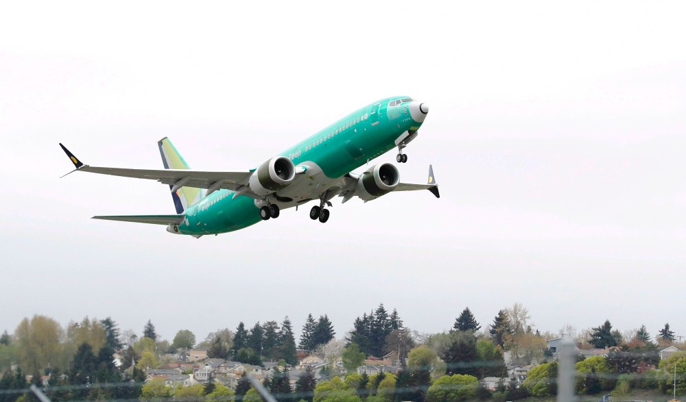 JATR will present observations of the 737 MAX
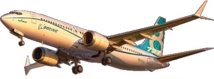
 AW | 2019 09 07 12:11 | INDUSTRY / AVIATION SAFETY
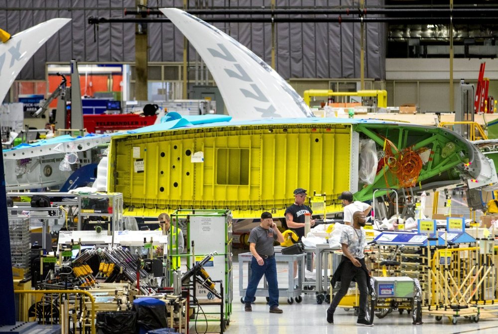 Boeing 777X alar load test failure
 AW | 2019 09 06 23:25 | AVIATION SAFETY / SAFETY/SECURITY
 Huracán Dorian ha impactado en el Estado de Carolina del Norte
 HURACÁN DORIAN IMPACTA EN OUTER BANK, ESTADO DE CAROLINA DEL NORTE
 Hurricane Dorian continues North Atlantic course
 AW | 2019 09 06 13:37 | AVIATION SAFETY / AIRPORT
 Humanitarian action in the Bahamas
 AW | 2019 09 05 23:29 | AVIATION SAFETY
 El Huracán Dorian azota los estados de las Carolinas
 Hurricane Dorian | Day 05/09
