Aerolíneas cancelan vuelos en Hawaii

AW | 2018 08 23 23:27 | AIR TRAFFIC / AVIATION SAFETY

Las aerolíneas con destinos a las Islas de Hawaii son canceladas por Huracán Lane

Imagen relacionadaLas aerolíneas están cancelando vuelos a medida que el Huracán Lane se aproxima a las Islas de Hawaii. El Gobierno de Estados Unidos ha tomado medidas para reducir el impacto.

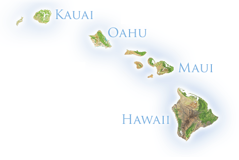
United Airlines está cancelando sus vuelos hacia y desde Maui el viernes. La aerolínea agregó dos vuelos adicionales desde Honolulu a San Francisco el jueves para ayudar a transportar personas fuera de las islas. United también está tomando medidas para asegurar su hangar en el Aeropuerto Daniel Resultado de imagen para Hawaiian airways pngK. Inouye en Honolulu. Hawaiian Airlines está cancelando todos los vuelos del viernes por su operador carguero Ohana este viernes a los aeropuertos de Kapalua y Lanai el jueves.

Hurricane Lane es actualmente una tormenta de Categoría 3, lo que significa que tiene vientos de 111 a 129 mph (178 kph a 207 kph). Los turistas todavía estaban nadando en el océano y colgando en la playa cuando el Huracán Lane se acercaba el jueves.

El Servicio Meteorológico Nacional bajó de categoría el huracán Lane a una tormenta de categoría 3, lo que significa vientos de 111 a 129 mph. Los meteorólogos dicen que la tormenta cambió previamente el jueves y ahora se está acercando a Hawaii. El Servicio Meteorológico Nacional informó que algunas partes de la Isla Grande han recibido 20 pulgadas de lluvia en las últimas 24 horas.

El huracán obligó a la Marina de los Estados Unidos a comenzar a mover sus barcos y submarinos lejos de las islas, según el Contraalmirante de la Armada Brian Fort. Dijo el miércoles que todos los barcos que actualmente no están bajo mantenimiento se están mudando fuera de Pearl Harbor y estarán posicionados para ayudar a responder después de la tormenta, si es necesario.

Ubicación/intensidad del Huracán Lane

El CPHC de la NOAA dijo que a las 11:00 a.m. EDT (5 a.m. HST/1500 UTC) del 22 Agosto 2018, el centro del Huracán Lane estaba ubicado cerca de la latitud 15.1 grados norte y la longitud 155.3 grados oeste. Eso es aproximadamente 315 millas (505 km) al sur de Kailua-Kona, Hawaii y cerca de 460 millas (740 km) al sur-sureste de Honolulu, Hawaii.

Lane se está moviendo hacia el oeste-noroeste cerca de 9 mph (15 kph) y se espera que este movimiento se convierta en noroeste más tarde hoy, seguido por un giro hacia el norte-noroeste el jueves. En el seguimiento del pronóstico, el centro de Lane se moverá muy cerca o sobre las principales islas de Hawaii de jueves a sábado, 25 Agosto 2018.

Los vientos máximos sostenidos están cerca de 155 mph (250 kph) con ráfagas más altas. Lane es un huracán de categoría 4 en la escala Saffir-Simpson Hurricane Wind Scale. Se pronostica cierto debilitamiento durante las próximas 48 horas, pero se pronostica que Lane seguirá siendo un huracán peligroso a medida que se acerca a las islas hawaianas. Los vientos huracanados se extienden hasta 40 millas (65 km) desde el centro y los vientos con fuerza de tormenta tropical se extienden hasta 140 millas (220 km). La presión central mínima estimada es de 935 milibares.  AIRWAYS® AW-Icon TXT

Resultado de imagen para HURRICANE LANE

Airlines cancel flights in Hawaii

Airlines with destinations to the Islands of Hawaii are canceled by Hurricane Lane

Airlines are canceling flights as Hurricane Lane approaches the Islands of Hawaii. The Government of the United States has taken measures to reduce the impact.

Resultado de imagen para united airlines pngUnited Airlines is canceling its flights to and from Maui on Friday. The airline added two additional flights from Honolulu to San Francisco on Thursday to help transport people off the islands. United is also taking steps to secure its hangar at Daniel K. Inouye Airport in Honolulu. Hawaiian Airlines is canceling all flights on Friday by its cargo operator Ohana this Friday to the airports of Kapalua and Lanai on Thursday.

Hurricane Lane is currently a Category 3 storm, which means it has winds of 111 to 129 mph (178 kph to 207 kph). Tourists were still swimming in the ocean and hanging on the beach when Hurricane Lane approached Thursday.

The National Weather Service downgraded Hurricane Lane to a category 3 storm, which means winds of 111 to 129 mph. Forecasters say the storm changed previously on Thursday and is now approaching Hawaii. The National Weather Service reported that some parts of the Big Island have received 20 inches of rain in the last 24 hours.

The hurricane forced the US Navy to start moving its ships and submarines away from the islands, according to Rear Admiral Brian Fort. He said on Wednesday that all ships currently not under maintenance are moving out of Pearl Harbor and will be positioned to help respond after the storm, if necessary.

Location / intensity of Hurricane Lane

The NOAA CPHC said that at 11:00 a.m. EDT (5 a.m. HST / 1500 UTC) on August 22, 2018, the center of Hurricane Lane was located near latitude 15.1 degrees north and longitude 155.3 degrees west. That’s roughly 315 miles (505 km) south of Kailua-Kona, Hawaii and about 460 miles (740 km) south-southeast of Honolulu, Hawaii.

Temperaturas frías encontradas en las tormentas eléctricas dentro de Lane

AN INFRARED LOOK BY NASA’S TERRA SATELLITE PROVIDED FORECASTERS WITH TEMPERATURE DATA IN THE CATEGORY 4 HURRICANE NEAR HAWAII. TERRA DATA SHOWED A LARGE RING OF COLDEST AND MOST POWERFUL STORMS AROUND HURRICANE LANE’S EYE ON AUGUST 23

Lane is moving west-northwest near 9 mph (15 kph) and this movement is expected to become northwest later today, followed by a north-northwest turn on Thursday. In tracking the forecast, the center of Lane will move very close or on the main islands of Hawaii from Thursday to Saturday, August 25, 2018.

The maximum sustained winds are about 155 mph (250 kph) with higher gusts. Lane is a category 4 hurricane on the Saffir-Simpson Hurricane Wind Scale. Weakness is predicted for the next 48 hours, but Lane is forecast to remain a dangerous hurricane as it approaches the Hawaiian Islands. Hurricane winds extend up to 40 miles (65 km) from the center and winds with tropical storm force extend up to 140 miles (220 km). The estimated minimum central pressure is 935 millibars. A \ W


Ξ A I R G W A Y S Ξ
SOURCE:  Airgways.com
DBk: Nasa.gov / Usatoday.com / Airgways.com / United.com / Hawaiianairlines.com
AW-POST: 201808232327AR

A\W   A I R G W A Y S ®

Nuevos indicios del Malaysia MH-370

AA-MH370.jpg

AW | 2018 08 23 18:23 | AIR INVESTIGATION / AVIATION SAFETY

AW-70083772Nuevos datos arrojan búsqueda en el séptimo arco de Océano Índico

El vuelo MH370 de Malaysia Airlines que transportaba a 239 personas, desapareció sobre el Océano Índico el 8 Marzo 2014.Todos los esfuerzos por rastrear el avión han fallado y el paradero del jet sigue siendo un misterio desde entonces.

Nuevas pistas del MH370

Esta semana, una nueva imagen de Google Maps envió a los teóricos de la conspiración al colapso después de que pareciera mostrar el avión desaparecido. Victor Iannello fue un miembro original del grupo independiente de especialistas que ayudó a los investigadores australianos a tratar de identificar el sitio del accidente del MH370 en el océano Índico al oeste de Australia.

Usando un nuevo análisis de datos del Australian Transport Safety Bureau (ATSB), cree que ha encontrado una posible ubicación del Boeing 777-200 perdido. Víctor Iannello escribió en su blog: “La próxima búsqueda debería ocurrir a lo largo del séptimo arco al norte de 25 grados sur a un ancho de más o menos 25 millas náuticas (46 km)”.

La búsqueda hasta ahora ha sido de 22 millas náuticas a cada lado del séptimo arco, que se ha descrito como “una línea delgada pero larga que incluye todos los puntos posibles donde podría haber tenido lugar la última comunicación conocida entre el avión y el satélite de comunicaciones”. Las 10 rutas de vuelo finales posibles de MH370 fueron examinadas por Iannello después de que se le dio acceso exclusivo a los datos de simulación producidos por Boeing para la ATSB.

Iannello dijo que “con el fracaso de la reciente búsqueda de Ocean Infinity para localizar el campo de escombros a lo largo del séptimo arco en latitudes tan al norte como 25 grados al sur y en anchuras iguales o superiores a más o menos 22 millas náuticas, tenemos que considerar si es posible que con el supuesto de un vuelo incontrolado, el avión podría haber afectado al océano más allá. Aunque las restricciones legales impiden que la ATSB proporcione detalles específicos sobre cada una de las 10 simulaciones (denominadas casos 1-10), la ATSB reveló que las velocidades iniciales variaban entre M0.75 (894 km / h) y M0.83, las altitudes iniciales eran FL350 (35,000 pies) o FL400, los títulos iniciales eran 178 grados, 184 grados o 190 grados, y la turbulencia era ligera o moderada”.

El avión condenado desapareció mientras viajaba de Kuala Lumpur a Beijing. Una búsqueda multimillonaria durante más de tres años no arrojó pistas concretas sobre el paradero del avión Boeing 777-200, intentado una vez más poder encontrar el fatídico Malaysia MH370. AIRWAYS® AW-Icon TXT

MH370

New indications of the MH-370

New data throw search in the seventh arch of the Indian Ocean

Malaysia Airlines flight MH370, carrying 239 people, disappeared over the Indian Ocean on March 8, 2014. All efforts to track the plane have failed and the whereabouts of the jet have remained a mystery ever since.

New tracks of the MH370

This week, a new Google Maps image sent the conspiracy theorists to collapse after it seemed to show the missing plane. Victor Iannello was an original member of the independent group of specialists who helped Australian researchers try to identify the site of the MH370 crash in the Indian Ocean west of Australia.

Using a new data analysis from the Australian Transport Safety Bureau (ATSB), he believes he has found a possible location for the lost Boeing 777-200. Victor Iannello wrote in his blog: “The next search should occur along the seventh arc north of 25 degrees south to a width of about 25 nautical miles (46 km)”.

The search so far has been 22 nautical miles on each side of the seventh arc, which has been described as “a thin but long line that includes all possible points where the last known communication between the aircraft and the satellite of communications”. The 10 possible final flight routes of MH370 were examined by Iannello after he was given exclusive access to the simulation data produced by Boeing for the ATSB.

Iannello said that “with the failure of Ocean Infinity’s recent search to locate the debris field along the seventh arc in latitudes as far north as 25 degrees south and in widths equal to or greater than about 22 nautical miles, we have to consider if it is possible that with the assumption of an uncontrolled flight, the plane could have affected the ocean beyond, although the legal restrictions prevent the ATSB from providing specific details about each of the 10 simulations (called cases 1-10) , the ATSB revealed that the initial speeds varied between M0.75 (894 km / h) and M0.83, the initial altitudes were FL350 (35,000 feet) or FL400, the initial titles were 178 degrees, 184 degrees or 190 degrees, and the turbulence was light or moderate”.

The condemned plane disappeared while traveling from Kuala Lumpur to Beijing. A multi-million dollar search for more than three years did not yield concrete clues about the whereabouts of the Boeing 777-200 aircraft, once again trying to find the fateful Malaysia MH370. A \ W


Ξ A I R G W A Y S Ξ
SOURCE:  Airgways.com
DBk: Atsb.gov.au / Airgways.com / Google.com
AW-POST: 201808231823AR

A\W   A I R G W A Y S ®

JetSmart proyecta La Serena-San Juan

Resultado de imagen para JetSmart Airlines La Serena

AW | 2018 08 23 17:17 | AIRLINES ROUTES

Imagen relacionadaLa aerolínea low cost chilena JetSmart Airlines iniciará vuelos desde La Senena a San Juan, Argentina

La aerolínea low cost JetSmart Airlines de Chile presentó un proyecto de explotación sobre la ruta La Serena, Chile y San Juan, Argentina con el objetivo es implementar un puente aéreo con frecuencias todo el año.

Friederike Kreebbers, Gerente de Itinerario y Desarrollo de Aeropuertos de la compañía JetSmart, expreso que “estamos interesados en atender la conectividad entre la Región de Coquimbo y la Provincia de San Juan y ser una alternativa aérea muy atrayente”. La Intendenta de Coquimbo, Lucía Pinto señalo que la “ruta aérea será una buena oportunidad de desarrollo comercial y turístico en los meses que está cerrado el Paso Agua Negra, es decir, entre abril y diciembre”.

Una de las dificultades es el costo de la tasa de embarque en el Aeropuerto Faustino Sarmiento de San Juan con respecto a la tasa de embarque del Aeropuerto La Serena, por lo que están acercando propuestas para reducir los costos operativos aeroportuarios.

JetSmart Airlines no ha comunicado el inicio de las operaciones para unir en un puente aéreo la costa pacífica chilena con la Región de Cuyo de Argentina. El tiempo estimado de vuelo de la futura ruta estará en 50 minutos de enlace. AIRWAYS® AW-Icon TXT

Resultado de imagen para JetSmart Airlines

JetSmart projects La Serena-San Juan

The low cost Chilean airline JetSmart Airlines will start flights from La Senena to San Juan, Argentina

The low cost airline JetSmart Airlines of Chile presented an exploitation project on the route La Serena, Chile and San Juan, Argentina with the aim of implementing an airlift with frequencies all year round.

Friederike Kreebbers, Airport Planning and Development Manager of the JetSmart company, stated that “we are interested in serving the connectivity between the Coquimbo Region and the Province of San Juan and being a very attractive alternative to the air”. The Intendente of Coquimbo, Lucia Pinto indicated that the “air route will be a good opportunity for commercial and tourist development in the months that the Agua Negra Pass is closed, that is, between April and December”.

One of the difficulties is the cost of the boarding fee at the Faustino Sarmiento Airport in San Juan with respect to the boarding fee at La Serena Airport, which is bringing proposals to reduce airport operating costs.

JetSmart Airlines has not announced the start of operations to link the Chilean Pacific coast with the Cuyo Region of Argentina on an airlift. The estimated flight time of the future route will be 50 minutes link. A \ W


Ξ A I R G W A Y S Ξ
SOURCE:  Airgways.com
DBk: Jetsmart.com / Airgways.com
AW-POST: 201808231717AR

A\W   A I R G W A Y S ®

MA-60 obtiene certificación en 14 países

Resultado de imagen para aircraft MA60

AW | 2018 08 23 05:44 | INDUSTRY

20160815070527!Logo_Avic.jpgEl turbohélice AVIC MA-60 ha obtenido la certificaciones tipo en catorce paísesResultado de imagen para Avic MA-60 png

Las aeronaves de pasajeros turbohélice AVIC MA-60 de China han obtenido la certificación en catorce países. La familia MA-60 está desempeñando un papel importante en la mejora de la influencia de los productos de aviación desarrollados en China y los estándares chinos, según AVIC Xi’an Aircraft Industry Group Company Ltd.

Hasta la fecha, los aviones de la serie MA-60 han sido certificados en 14 países, incluidos Indonesia, Laos, Filipinas, Nepal, Camerún y Sudáfrica. Los aviones MA-60 turbohélice están diseñados para operar vuelos regionales, y también pueden ser modificados para servir como aviones de propósito especial, por ejemplo en operaciones de siembra de nubes. El avión actualmente opera en aproximadamente 300 rutas aéreas y ha transportado a más de 11 millones de pasajeros en todo el mundo, según AVIC Xi’an Aircraft.  AIRWAYS® AW-Icon TXT

Resultado de imagen para avic MA-60Resultado de imagen para avic MA-60

MA60 from China obtains certification in 14 countries

The AVIC MA-60 turboprop has obtained the type certifications in fourteen countries

The AVIC MA-60 turboprop passenger aircraft from China has obtained certification in fourteen countries. The MA-60 family is playing an important role in improving the influence of aviation products developed in China and Chinese standards, according to AVIC Xi’an Aircraft Industry Group Company Ltd.

To date, the MA-60 series aircraft have been certified in 14 countries, including Indonesia, Laos, the Philippines, Nepal, Cameroon and South Africa. MA-60 turboprop aircraft are designed to operate regional flights, and can also be modified to serve as special purpose aircraft, for example in cloud seeding operations. The aircraft currently operates on approximately 300 air routes and has transported more than 11 million passengers worldwide, according to AVIC Xi’an Aircraft. A \ W


Ξ A I R G W A Y S Ξ
SOURCE:  Airgways.com
DBk: Avic.com / China.org.cn / Wikimedia.org / Strategic-bureau.com
AW-POST: 201808230544AR

A\W   A I R G W A Y S ®