Huracán Dorian | Día 29/08
 AW | 2019 08 29 23:55 | AVIATION SAFETY
El Huracán Dorian podría afectar el Estado de Florida como tormenta  de Categoría 5
El Huracán Dorian ha entrado actualmente en Categoría 1 con vientos de 85 mph y fuertes lluvias, pronostican se convierta en los próximos dos días al menos alcance la Categoría 4, lo que significa vientos de más de 130 mph.
«Con el pronóstico de Dorian de pasar sobre el agua extremadamente cálida de la Corriente del Golfo, donde el agua enfriada y soldada es reemplazada rápidamente por agua más cálida, preocupan a los pronosticadores en meteorología de que haya una Categoría 5 sobre la mesa antes de llegar a la costa de los Estados Unidos», advirtió hoy Jueves 29/08 el meteorólogo principal de AccuWeather, Alex Sosnowski.
El Huracán Dorian se encontraba a 330 millas al este de las Bahamas el jueves por la noche, y se esperaba que alcanzara el extremo sureste del archipiélago durante la noche. La tormenta evitó en gran medida a Puerto Rico a principios de la semana cuando se desvió hacia el norte antes de golpear el territorio de los Estados Unidos, pero dejó grandes inundaciones a su paso. Los aguaceros de la cola del huracán sumergieron automóviles y casas a lo largo de las áreas costeras en Puerto Rico, y el Servicio Meteorológico Nacional emitió una advertencia de inundación repentina para las partes orientales de la isla.
Proyección hacia Estados Unidos
Los residentes del Estado de Florida recogieron los estantes de las tiendas y se alinearon en las estaciones de servicio el Jueves 29/08 cuando el Huracán Dorian avanzó hacia la costa este del estado, y los meteorólogos temen que podría convertirse en una tormenta de Categoría 5 (Cat 5) para cuando llegue a tierra el Domingo 1 Septiembre 2019, con vientos a una velocidad que superara las 157 mph.
Aunque se espera que Dorian llegue a Florida, los meteorólogos advierten que sigue siendo algo impredecible. No han podido determinar exactamente dónde tocará tierra, que podría estar en cualquier lugar dentro de un tramo de 500 millas entre los Cayos de Florida y la costa sur del Estado de Georgia.
El Gobernador de Florida, Ron DeSantis, calificó la tormenta como «un cono de incertidumbre que extiende a todo el estado». El gobernador, quien declaró el estado de emergencia a lo largo de las porciones este y central de su estado el miércoles, extendió la declaración a todos los 67 condados de Florida el jueves. Advirtió a los residentes que esperen apagones e inundaciones cuando Dorian golpea, y que estén preparados para lo peor.![]()

Hurricane Dorian | Day 29/08
Hurricane Dorian could affect the State of Florida as a Category 5 storm
Hurricane Dorian has now entered Category 1 with winds of 85 mph and heavy rains, forecast to become the next two days at least reach Category 4, which means winds of more than 130 mph.
«With Dorian’s prognosis of passing over the extremely warm water of the Gulf Stream, where cooled and welded water is quickly replaced by warmer water, meteorological forecasters are concerned that there is a Category 5 on the table before to get to the coast of the United States», warned today Thursday 29/08 the main meteorologist of AccuWeather, Alex Sosnowski.
Hurricane Dorian was 330 miles east of the Bahamas on Thursday night and was expected to reach the southeast end of the archipelago during the night. The storm largely avoided Puerto Rico at the beginning of the week when it swerved north before hitting the territory of the United States, but left large floods in its wake. The downpours of the hurricane’s tail submerged cars and houses along with coastal areas in Puerto Rico, and the National Weather Service issued a flash flood warning for the eastern parts of the island.
Projection to the United States
Florida State residents picked up store shelves and lined up at service stations on Thursday, 08/29 when Hurricane Dorian advanced to the east coast of the state, and meteorologists fear it could turn into a Category 5 storm (Cat 5) by the time it reaches land on Sunday 1 September 2019, with winds at a speed that will exceed 157 mph.
Although Dorian is expected to arrive in Florida, meteorologists warn that it remains somewhat unpredictable. They have not been able to determine exactly where it will land, which could be anywhere within a 500-mile stretch between the Florida Keys and the southern coast of the State of Georgia.
Florida Governor Ron DeSantis called the storm «a cone of uncertainty that extends throughout the state». The governor, who declared a state of emergency along the eastern and central portions of his state on Wednesday, extended the statement to all 67 Florida counties on Thursday. He warned residents to expect blackouts and floods when Dorian hits, and be prepared for the worst. A \ W
Asesor Público del Huracán Dorian
289
WTNT35 KNHC 292045
TCPAT5

BOLETÍN
Huracán Dorian Número Asesor 22
NWS National Hurricane Center Miami FL AL052019
500 PM AST jue 29 ago 2019

... PRONÓSTICO DE DORIAN PARA INTENSIFICAR DURANTE LA PRÓXIMA PAREJA DE DÍAS ...


RESUMEN DE 500 PM AST ... 2100 UTC ... INFORMACIÓN
----------------------------------------------
UBICACIÓN ... 22.5N 67.7W
ACERCA DE 330 MI ... 535 KM E DE LAS BAHAMAS DEL SURESTE
VIENTOS MÁXIMOS SOSTENIDOS ... 85 MPH ... 140 KM / H
MOVIMIENTO ACTUAL ... NO O 325 GRADOS A 13 MPH ... 20 KM / H
PRESIÓN CENTRAL MÍNIMA ... 986 MB ... 29.12 PULGADAS


RELOJES Y ADVERTENCIAS
--------------------
No hay alertas costeras ni advertencias vigentes.

Los intereses en el noroeste y el centro de Bahamas deben monitorear el
progreso de Dorian. Se pueden requerir relojes para partes de este
zona los viernes.


DISCUSIÓN Y PERSPECTIVAS
----------------------
A las 500 PM AST (2100 UTC), se ubicó el centro del huracán Dorian
cerca de la latitud 22.5 norte, longitud 67.7 oeste. Dorian se está moviendo
hacia el noroeste cerca de 13 mph (20 km / h), y este general
Se espera que la moción continúe hasta el viernes. Un oeste-noroeste hacia
se pronostica que el movimiento hacia el oeste comenzará el viernes por la noche y continuará
en el fin de semana En esta pista, Dorian debería moverse sobre el
Atlántico bien al este del sureste y centro de Bahamas esta noche
y el viernes, acércate el sábado al noroeste de Bahamas y muévete
cerca o sobre porciones del noroeste de Bahamas el domingo.

Los vientos máximos sostenidos son cerca de 85 mph (140 km / h) con mayor
ráfagas Se pronostica fortalecimiento durante los próximos días, y
Se espera que Dorian se convierta en un huracán importante el viernes, y
sigue siendo un huracán extremadamente peligroso durante el fin de semana.

Los vientos huracanados se extienden hacia afuera hasta 15 millas (30 km) del
vientos centrales y de tormenta tropical se extienden hacia afuera hasta 90 millas
(150 km).

La presión central mínima estimada es de 986 mb (29.12 pulgadas).


PELIGROS QUE AFECTAN LA TIERRA
----------------------
LLUVIA: Se espera que Dorian produzca la siguiente lluvia
acumulaciones este fin de semana hasta principios de la próxima semana:

El centro de Bahamas ... 1 a 2 pulgadas, aislado 4 pulgadas.
El noroeste de Bahamas ... 3 a 5 pulgadas, aislado 7 pulgadas.
Secciones costeras del sudeste de los Estados Unidos ... 5 a 10 pulgadas,
aislado 15 pulgadas.

Esta lluvia puede causar inundaciones repentinas que amenazan la vida.

SURF: Oleaje en las Islas Vírgenes de EE. UU. Y Gran Bretaña y
Puerto Rico debería disminuir gradualmente hoy. Es probable que las olas
comenzar a afectar las costas orientadas al este de las Bahamas y el
costa sureste de los Estados Unidos durante los próximos días. Estas
es probable que las olas causen corrientes de resaca y desgarre que pongan en peligro la vida
condiciones Consulte los productos de su oficina meteorológica local.


PRÓXIMA ADVERTENCIA
-------------
Siguiente aviso completo a las 11:00 PM AST.

$$
Hurricane Dorian Public Advisory
289
WTNT35 KNHC 292045
TCPAT5

BULLETIN
Hurricane Dorian Advisory Number  22
NWS National Hurricane Center Miami FL       AL052019
500 PM AST Thu Aug 29 2019

...DORIAN FORECAST TO INTENSIFY DURING THE NEXT COUPLE OF DAYS...


SUMMARY OF 500 PM AST...2100 UTC...INFORMATION
----------------------------------------------
LOCATION...22.5N 67.7W
ABOUT 330 MI...535 KM E OF THE SOUTHEASTERN BAHAMAS
MAXIMUM SUSTAINED WINDS...85 MPH...140 KM/H
PRESENT MOVEMENT...NW OR 325 DEGREES AT 13 MPH...20 KM/H
MINIMUM CENTRAL PRESSURE...986 MB...29.12 INCHES


WATCHES AND WARNINGS
--------------------
There are no coastal watches or warnings in effect.

Interests in the northwestern and central Bahamas should monitor the
progress of Dorian.  Watches may be required for portions of this
area on Friday.


DISCUSSION AND OUTLOOK
----------------------
At 500 PM AST (2100 UTC), the center of Hurricane Dorian was located
near latitude 22.5 North, longitude 67.7 West. Dorian is moving
toward the northwest near 13 mph (20 km/h), and this general
motion is expected to continue through Friday.  A west-northwestward
to westward motion is forecast to begin by Friday night and continue
into the weekend.  On this track, Dorian should move over the
Atlantic well east of the southeastern and central Bahamas tonight
and on Friday, approach the northwestern Bahamas Saturday, and move
near or over portions of the northwest Bahamas on Sunday.

Maximum sustained winds are near 85 mph (140 km/h) with higher
gusts.  Strengthening is forecast during the next few days, and
Dorian is expected to become a major hurricane on Friday, and
remain an extremely dangerous hurricane through the weekend.

Hurricane-force winds extend outward up to 15 miles (30 km) from the
center and tropical-storm-force winds extend outward up to 90 miles
(150 km).

The estimated minimum central pressure is 986 mb (29.12 inches).


HAZARDS AFFECTING LAND
----------------------
RAINFALL:  Dorian is expected to produce the following rainfall
accumulations this weekend into early next week:

The central Bahamas...1 to 2 inches, isolated 4 inches.
The northwestern Bahamas...3 to 5 inches, isolated 7 inches.
Coastal sections of the Southeast United States...5 to 10 inches,
isolated 15 inches.

This rainfall may cause life-threatening flash floods.

SURF:  Swells around the U.S. and British Virgin Islands and
Puerto Rico should gradually diminish today.  Swells are likely to
begin affecting the east-facing shores of the Bahamas and the
southeastern United States coast during the next few days.  These
swells are likely to cause life-threatening surf and rip current
conditions.  Please consult products from your local weather office.


NEXT ADVISORY
-------------
Next complete advisory at 1100 PM AST.

$$
Forecaster Brown
![]()
HURRICANE SAFETY CHECKLIST
Ξ A I R G W A Y S Ξ
SOURCE: Airgways.com
DBk: Noaa.gov / Accuweather.com / Nypost.com / Weather.com / Redcross.org
AW-POST: 201908292355AR
A\W A I R G W A Y S ®
 AW | 2019 08 29 17:35 | AIRLINES ROUTES
 La aerolínea Flybondi anuncia nueva ruta Buenos Aires-Porto Alegre
 Flybondi Buenos Aires-Porto Alegre
 Flybondi airline announces new route Buenos Aires-Porto Alegre
 Flybondi Buenos Aires-Porto Alegre
 A companhia aérea de baixo custo Flybondi Líneas Aéreas está estudando uma nova rota Buenos Aires-Porto Alegre. Após anunciar recentemente vôos diretos da Argentina para Florianópolis e Rio de Janeiro, a Flybondi entra em uma terceira rota que impulsiona a expansão para o mercado regional. Flybondi expressou que a negociação é uma prioridade para oferecer links diretos Buenos Aires/El Palomar-Porto Alegre e Buenos Aires/El Palomar-São Paulo.
 AW | 2019 08 29 16:40 | INDUSTRY
 Embraer postponed rollout E175-E2
 Lançamento adiado da Embraer E175-E2
 A fabricante brasileira Embraer informou que o Programa E-175-E2 pode ser adiado até 2021. Na linha de montagem, o primeiro protótipo Embraer E175-E2 está em um estágio avançado de desenvolvimento. O CEO da Embraer, John Slattery, disse que o atual organograma do projeto será adiado alguns meses após a data de 2021. As razões para os atrasos são determinadas pela falta de fluxo de caixa.
 AW | 2019 08 29 15:27 | AIRPORTS / GOVERNMENT
 Final cancellation of the NAIM Airport
 AW | 2019 08 29 15:00 | AIRLINES / AIR TRAFFIC
 Iberia strike in Madrid and Barcelona
 Vaga Iberia a Madrid i Barcelona
 AW | 2019 0829 13:05 | AIRLINES / INDUSTRY
 Air Vanuatu will incorporate Airbus A220
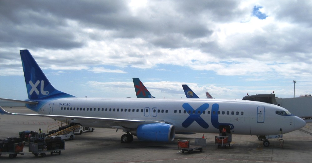 AW | 2019 08 29 12:19 | AIRLINES
 XL Airways possible sale
 XL Airways vente possible
 AW | 2019 08 29 11:51 | AIRLINES
 La nueva aerolínea Holiday Europe inicia operaciones
 AW | 2019 08 29 11:35 | AIRLINES / MRO
 American Airlines anunció el Miércoles 28/08 que está forjando una presencia aún mayor, después de 73 años en Tulsa, incorporando 400 empleos a las instalaciones de mantenimiento de la aerolínea. El trabajo de mantenimiento adicional, incluido el mantenimiento programado en la flota de Boeing 787, requirió los nuevos puestos en Tech Ops Tulsa, que ya emplea a 5.200 personas. La contratación, principalmente para mecánicos con licencia de la Administración Federal de Aviación (FAA), continuará durante los próximos cuatro meses, dijo Erik Olund, Director Gerente de Mantenimiento de bases para American Airlines. «Es un gran día para nosotros en la base de Tulsa. Estamos haciendo crecer la organización considerablemente, y no hemos tenido un anuncio de contratación como este en más de una década. Esto allana el futuro para que estemos aquí por mucho tiempo», expresó el director.
 American incorporates 400 jobs in Tulsa
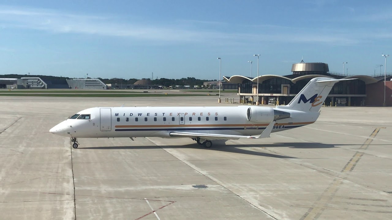 AW | 2019 08 29 11:00 | AIRLINES
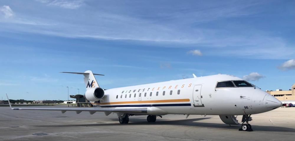 Midwest Express relaunches operations
 Midwest Express was founded in 1984 and became the «hometown airline» of Milwaukee. Midwest Express Airlines operated from 1984 to 2009. It was based in Oak Creek and operated from General Mitchell International Airport. It was renamed Midwest Airlines in 2002 and ceased operations in 2010, being part of agreements with TPG and Northwest Airlines, Republic Airways and Frontier. In April 2010, the airline merged with Frontier Airlines and the Midwest brand disappeared in 2011. They were recognized nationally for their nonstop service to the Midwestern cities of the United States, excellent customer service, comfortable seating and cookies from Hot chocolate for passengers.