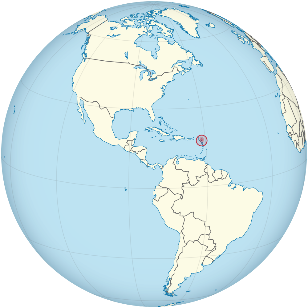
Antillas Menores están bajo vigilancia de tormenta tropical Harvey

AW | 2017 08 17 17:47 | SAFETY / SECURITY
Un avión cazahuracanes visitará esta tarde el sistema para definir la trayectoria del sistema y su intensidad
El Centro Nacional de Huracanes (NHC, por sus siglas en inglés) emitió este mediodía una vigilancia de tormenta tropical para varias Antillas Menores ante la inminente formación ciclónica del noveno sistema que se desarrolla en esta temporada de huracanes.
Hasta el momento, la zona de baja presión, nombrada invest 91L, no ha sido catalogada como una depresión o tormenta por el NHC porque no ha logrado cumplir con todos los requisitos meteorológicos. El sistema debe tener vientos en todas las direcciones, un eje de circulación definido y que se convierta en una baja presión independiente de los vientos alisios.
Hasta el momento, se ha informado que el sistema logró, para las 11:00 a.m., vientos con fuerza de depresión tropical de 35 millas por hora. A esta hora, el invest 91L se encontraba en la latitud 13.1 grados norte y la longitud 54.1 grados oeste, a unas 365 millas al este de Barbados y a 465 millas al este de Santa Lucía. Se mueve al oeste a 17 millas por hora.
La agencia meteorológica proyecta que en las próximas horas se fortalezca y se convierta en un ciclón. Por tal razón, emitió el primer boletín del “potencial de ciclón tropical” del sistema número nueve. Estas alertas son parte de los nuevos servicios que da la Administración Nacional de Océanos y Atmósfera (NOAA, por sus siglas en inglés) para avisar del posible impacto de un disturbio con 48 horas de anticipación.
Específicamente, el aviso de tormenta tropical incluye a Martinica, Santa Lucía, Barbados, San Vicente y Las Granadinas. Este boletín alerta del inminente paso del sistema por la zona. Por otro lado, una vigilancia de tormenta tropical está en efecto para Dominica. Esto quiere decir que algunos efectos del sistema podrían afectar a esa isla.
La posible trayectoria del sistema, que podría ser nombrada como Harvey de lograr formación ciclónica, la ubica pasando al sur de Puerto Rico para el sábado en la mañana como tormenta tropical. Se proyecta que para el lunes próximo se convierta en huracán y que a finales de la próxima semana impacte a Belice y a la península de Yucatán.
Un avión cazahuracanes visitará esta tarde esta zona de baja presión que se aproxima a las Antillas Menores. Se busca definir la trayectoria y la intensidad con la que pudiera azotar a las islas. Este sistema es solo uno de los tres que se desarrollan actualmente en aguas del océano Atlántico y se encaminan hacia el Caribe.
Detrás del invest 91L está otra zona de baja presión con potencial mediano de desarrollo ciclónico. Específicamente, el NHC le da 50% de probabilidad de desarrollo en las próximas 48 horas y 60% en los próximos cinco días.
Se espera que este sistema, nombrado invest 92L, sea el que pase más cerca de la isla, por la región noreste, entre el domingo en la noche y el lunes en la mañana. Planteó que todavía se desconoce si el mismo podría tener algún impacto en lluvias o vientos. pero todavía no está bien organizada. ![]()
The Lesser Antilles are under tropical storm surveillance
A jet aircraft hunter will visit this afternoon the system to define the trajectory of the system and its intensity
The National Hurricane Center (NHC) issued a tropical storm watch for several Lesser Antilles this afternoon due to the imminent cyclone formation of the ninth system that develops in this hurricane season.
So far, the low pressure zone, named invest 91L, has not been classified as a depression or storm by the NHC because it has failed to meet all weather requirements. The system must have winds in all directions, a defined axis of circulation and that it becomes a low pressure independent of the trade winds.
So far, it has been reported that the system achieved, at 11:00 a.m., winds with a tropical depression force of 35 miles per hour. At this time, the 91L was located at latitude 13.1 degrees north and longitude 54.1 degrees west, about 365 miles east of Barbados and 465 miles east of Saint Lucia. It moves west at 17 mph.
The meteorological agency projects that in the next few hours it will strengthen and become a cyclone. For this reason, it issued the first bulletin of the «tropical cyclone potential» of system number nine. These alerts are part of the new services provided by the National Oceanic and Atmospheric Administration (NOAA) to warn of the potential impact of a disturbance 48 hours in advance.
Specifically, the Tropical Storm Warning includes Martinique, Saint Lucia, Barbados, Saint Vincent and the Grenadines. This bulletin warns of the impending passage of the system by the zone. On the other hand, a tropical storm watch is in effect for Dominica. This means that some effects of the system could affect that island.
The possible trajectory of the system, which could be named as Harvey to achieve cyclonic formation, places it passing to the south of Puerto Rico for Saturday morning as a tropical storm. It is projected that by next Monday it will become a hurricane and that by the end of next week it will impact Belize and the Yucatan peninsula.
A hunter aircraft will visit this afternoon low pressure zone that is approaching the Lesser Antilles. It seeks to define the trajectory and intensity with which it could lash the islands. This system is only one of the three that are currently developing in waters of the Atlantic Ocean and are heading towards the Caribbean.
Behind the 91L is another low pressure zone with medium potential for cyclonic development. Specifically, the NHC gives 50% chance of development in the next 48 hours and 60% within the next five days.
This system, named invest 92L, is expected to be the closest to the island, in the northeast, between Sunday night and Monday morning. He said it is still unknown if it could have any impact on rain or wind, it’s still not well organized. A \ W
Ξ A I R G W A Y S Ξ
SOURCE: Airgways.com
DBk: Rec-end.gfrcdn.net
AW-POST: 201708171747AR
A\W A I R G W A Y S ®

 John, en Antigua & Barbuda abrirá esta semana el acceso a más destinos con el lanzamiento de su Interline Gateway
 información entre los distintos sistemas informáticos de las compañías aéreas. Amadeus actúa como una plataforma central y como gestor de las conexiones entre todos los sistemas de las líneas aéreas.
 Amadeus’ ETS Interline Gateway system allows an airline to issue electronic tickets for routes involving flights or flight connections operated by the associated airlines (process called interlining). With a simple connection, the airlines transfer their information to Amadeus which, in turn, translates and channels information between airlines’ different computer systems. Amadeus acts as a central platform and as a manager of connections between all airline systems.

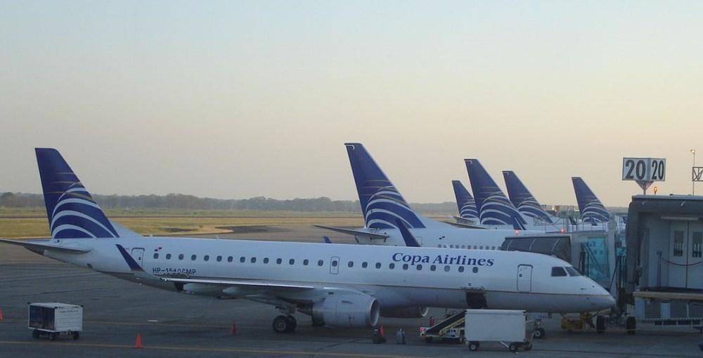
 Copa Airlines sumará 7 frecuencias semanales a su ruta Córdoba-Panamá, por lo cual a partir del 2 de diciembre los pasajeros cordobeses podrán conectarse dos veces por día con los 75 destinos que tiene la aerolínea en la región.
 Copa Airlines has announced the incorporation of 7 weekly frequencies to unite Cordoba with Panama